A road trip to Spiti valley through Kinnaur, Sangla and Pin was long overdue. When the opportunity knocked the doors in Autumn 2017, we, the footloose wanderers set out for this splendid journey to experience, capture and share the unending sequence of breathtaking scenery of these picturesque Himalayan valleys.
Situated in southeastern Himachal at an altitude from 2,320 to 6,816 meters, Kinnaur valley is the natural gateway to the Spiti valley. Apart from being famous for its apples and sacred mountain Kinner Kailash, the valley is blessed with scenic mountain valleys, temples built following traditional wooden architecture, rivers with deep gorges and a cultural harmony of Hinduism with Buddhism.
The Route
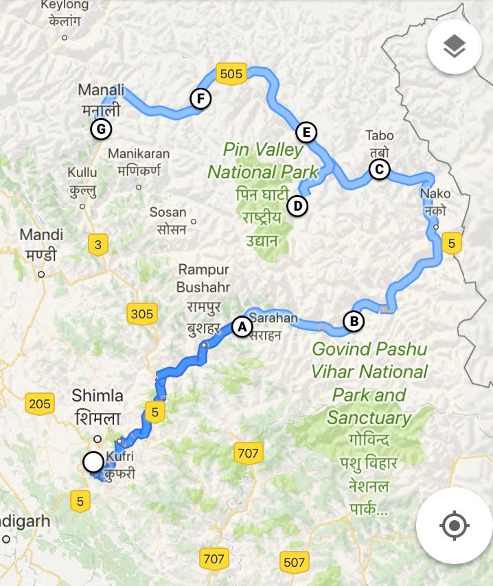
After doing some basic research, we decided to stick to the most popular route to cover the valley by entering it through Shimla – Kinnaur and then completing the circuit at Manali. Apart from optimum acclimatization, this route also allows scenic detours into two Himalayan valleys – the gorgeous Sangla valley along the Bapsa River and the majestic Pin valley along the Pin River.
The key places covered in our route plan are:
Shimla – Sarahan – Sangla – Chitkool – Kalpa – Nako – Tabo – Kaza – Kibber – Kunzum Pass – Chandrataal – Rohtang Pass – Manali
Chandigarh – Shoghi
Our long anticipated sojourn suffered a hiccup when Dera Sacha Sauda’s members decided to take law into their own hands to protest Gurmeet Ram Rahim’s conviction in Panchkula on 25th August. This resulted in curfews and road closures/diversions in and around Chandigarh and Panchkula. But the urge to explore the unknown won out and we decided to stick to our original plans except for a few route adjustments in the very first day of the trip.
Our journey commenced from New Delhi airport – we took the morning flight to Chandigarh and wanted to stay overnight at Narkanda (approx. 180 KM). But, after reaching Panchkula, we had to re-plan our day since vehicular movement was severely restricted around Chandigarh to deter repeat violence. So we decided to break our first day’s journey at Shoghi, 75 km short of our original destination Narkanda.


Shoghi – Narkanda – Rampur – Sarahan
On second day, we covered the 175 kms stretch from Shoghi to Sarahan (approx. 6 hours) along the Hindustan Tibet highway passing through the hill towns of Narkanda, Rampur and Jeori. Sarahan was our original stop for the second day, and thus we compensated for our first day’s truncated journey by traveling a longer distance on the second day.

Rampur, the winter capital of the erstwhile Bashahr principality, is situated at a height of 3350 feet on the left bank of the Sutlej. It is famous for the The Nathpa Jhakri Hydro Power Station built by Satluj Jal Vidyut Nigam Ltd., the largest hydro power project in Asia with the world’s deepest surge shaft at Shah (22 km from Rampur).
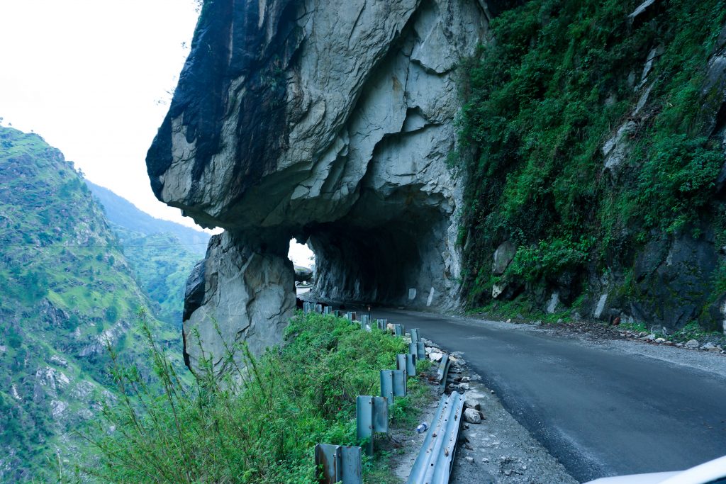
We continued along the Hindustan Tibet highway till Jeori and then took a right turn for Sarahan. The original road to Sarahan was damaged by landslide this year and an alternate road opened in its place that tortuously winds through apple orchards, private courtyards and even through animal sheds. Ill-maintained and unpaved, this road is only suitable for vehicles with high ground clearance and for drivers with a high-degree of eye-hand coordination.
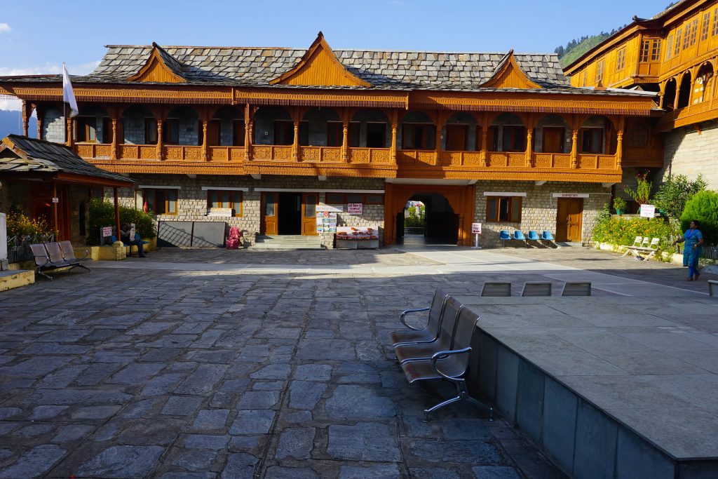
Sarahan, at 6900 feet, was the summer capital of the Bushahr kingdom and is built around the ancient Bhimakali temple, the presiding deity of the Bushahr royal family. It is also known as the “gateway of Kinnaur” due to its close proximity to the old Indo-Tibetan Road.

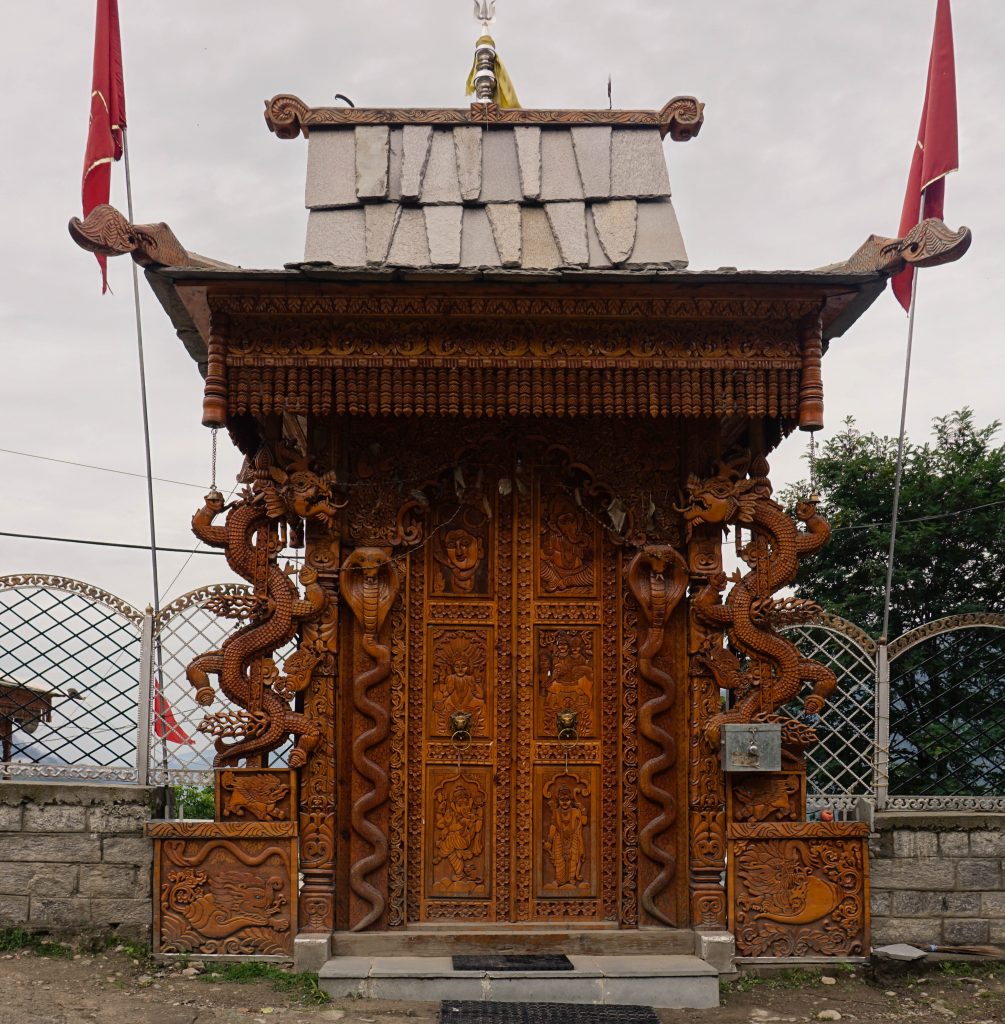
The Bhimakali temple is an exquisite example of the Indo-Tibetan architecture, intermixing the cultural influences of both Hinduism and Vajrayana Buddhism. It is an important centre of pilgrimage too, and is among the 51 Shaktipeethas of Shaivaite Hinduism.
The entire Kinnaur area has a long tradition where both the Buddhists and Hindus have lived in perfect harmony. It is quite common to come across Hindu and Buddhist symbols co-existing together on temple carvings and monastery paintings.
The economy of the Kinnaur region is heavily dependent on cultivation of fruits – apples, apricots, walnuts, pears. Apple orchards abound in Shimla, Kullu, Sirmour, Mandi, Chamba and Kinnaur districts of Himachal Pradesh.
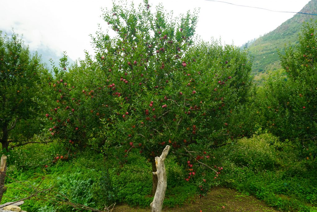
Plantings start in January-February every year and harvesting takes place in August – September. Apple trees start bearing fruits from the eighth year and continues for the next 30 years at the minimum.
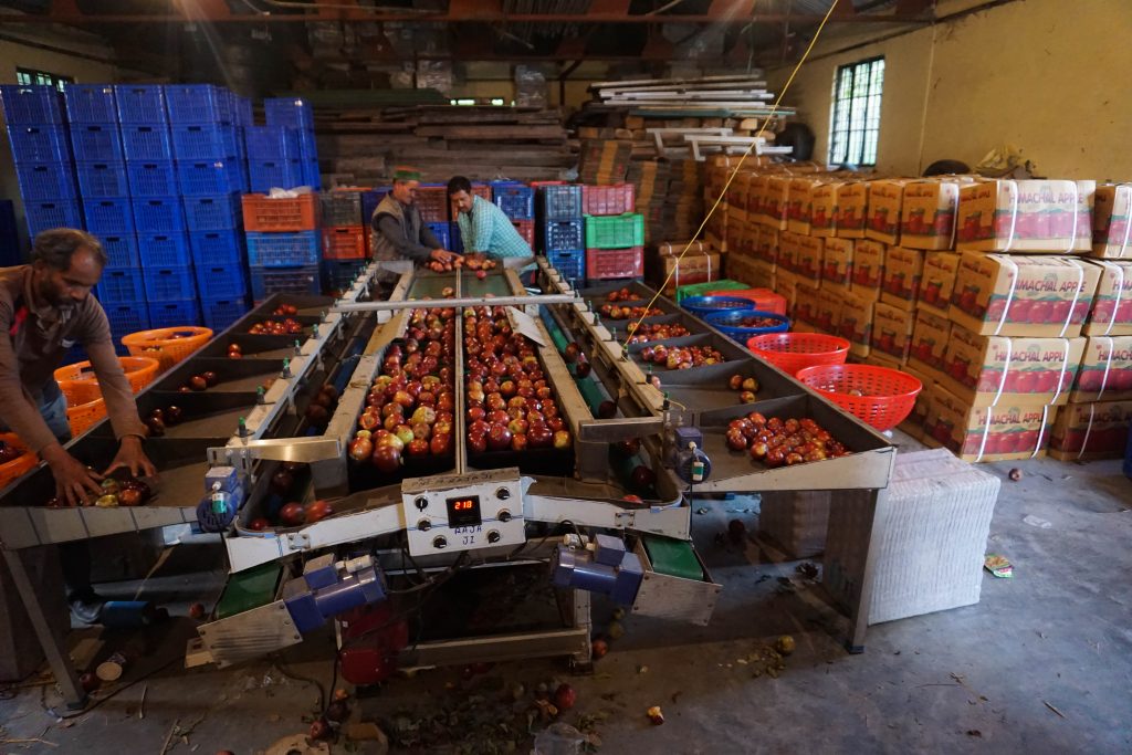
During the harvesting season, the emerald green of the hills are interspersed by the rubies of the heavily laden apple trees. Post harvesting, apples are sorted and graded manually according to size, appearance or quality.
Thereafter, they are packed in wooden crates and dispatched by road transport to the major cities of Delhi and Chandigarh, from whence they travel cross the country or are exported.
Sarahan – Sangla – Chitkool
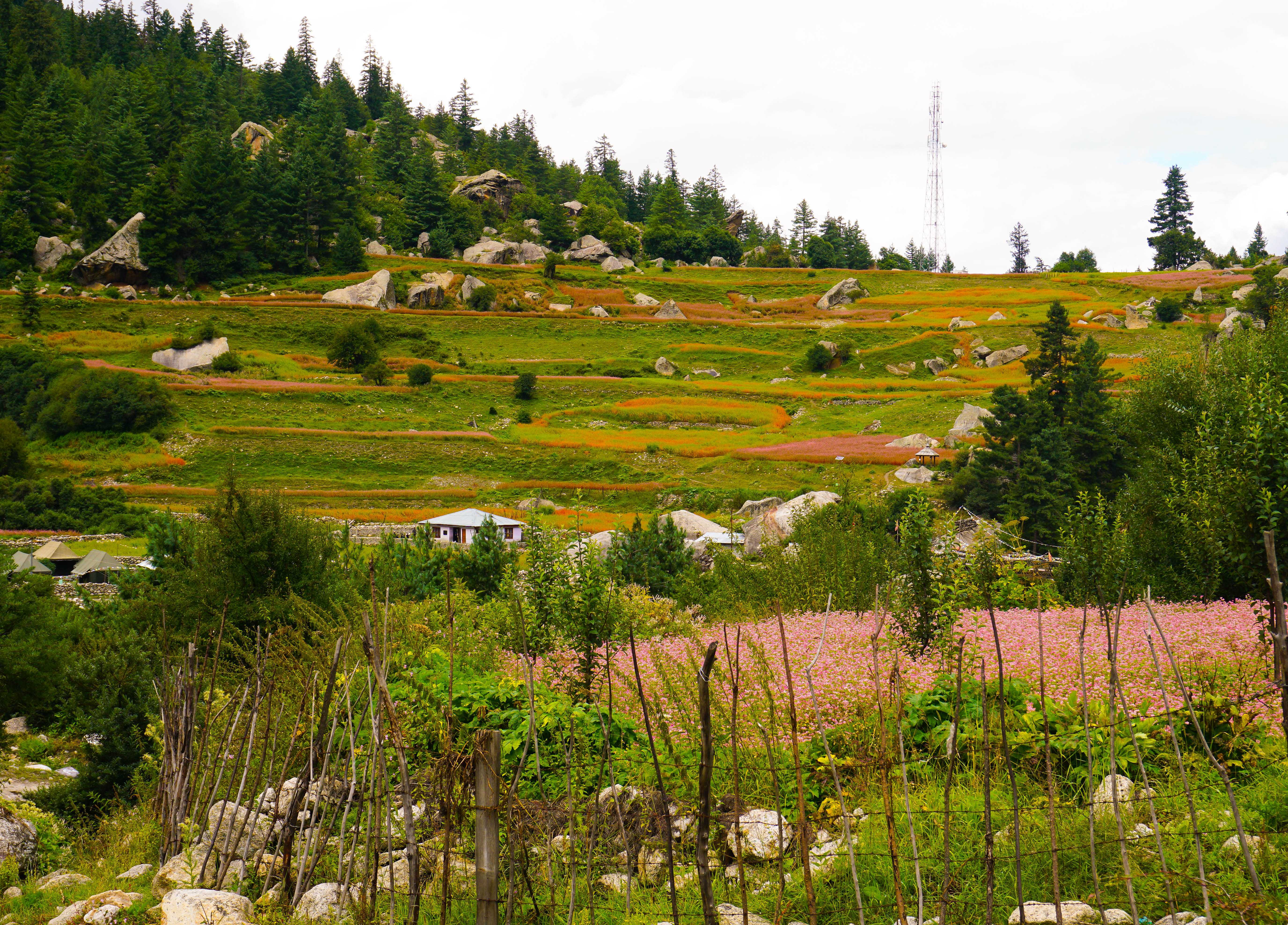
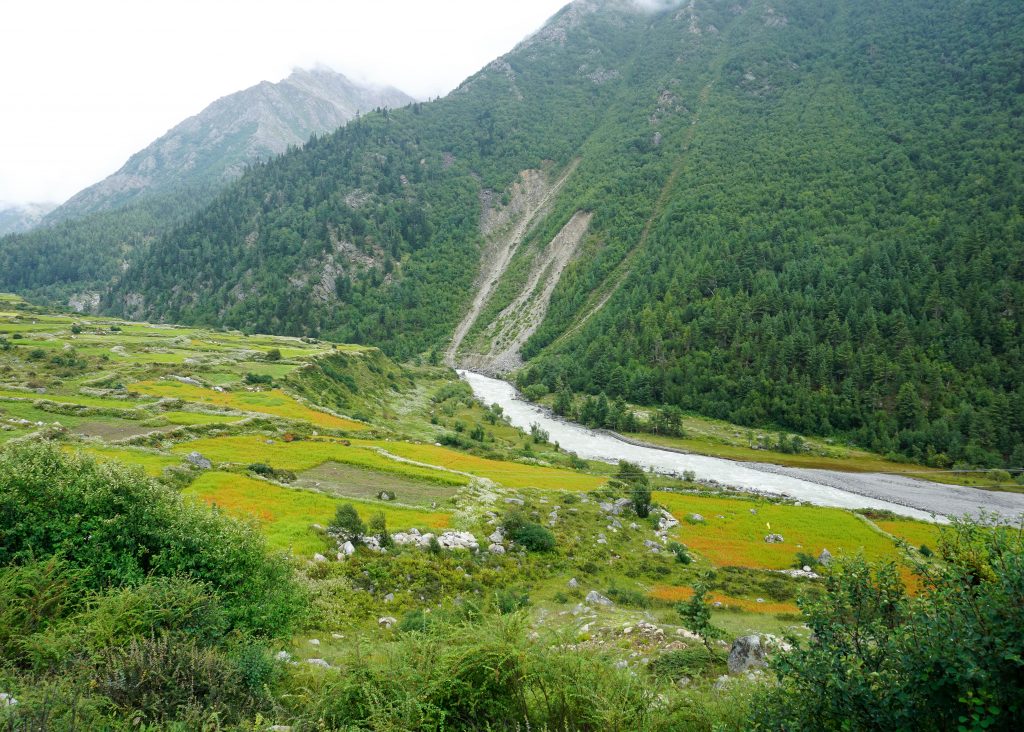
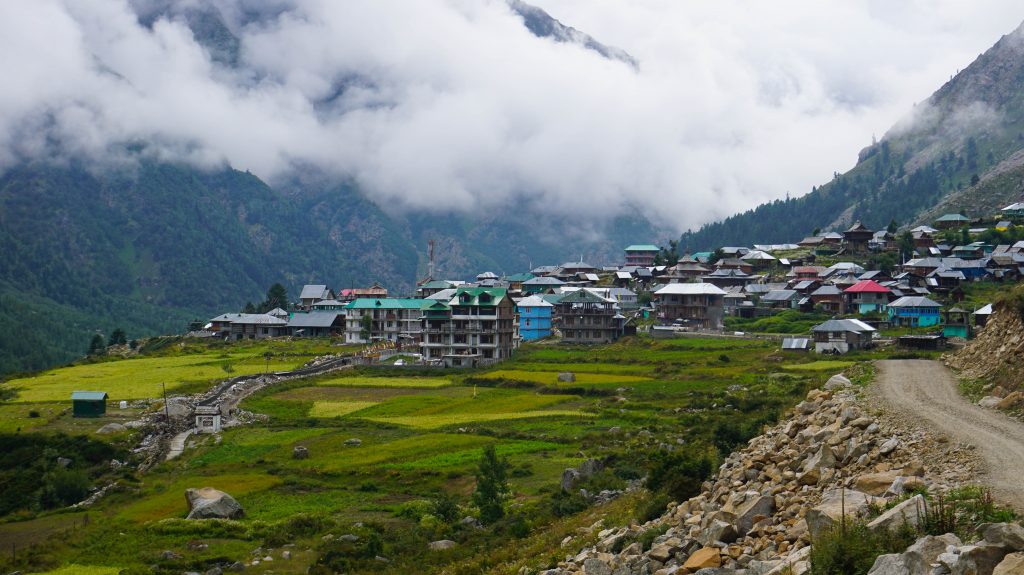
On the third day, we set out for a leisurely journey deep into the Kinnaur valley and covered the scenic Himalayan villages of Sangla, Rakchham, Batesari and Chitkool along the Baspa River. This was an optional detour of 120 kms but worth doing, to experience these hidden gems off the beaten track.
Though Baspa valley actually starts from Karchham, the area is popularly known as Sangla valley following the name of its biggest village, Sangla. Till 1989 this area had minimal outside influence as non-residents could not enter the valley without a special permit from the Government of India. This was primarily due to its strategic position on the Indo-Tibet/China border. As a result, it retained its unique way of life as also the untouched landscape.
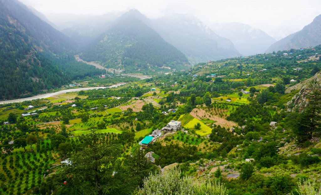
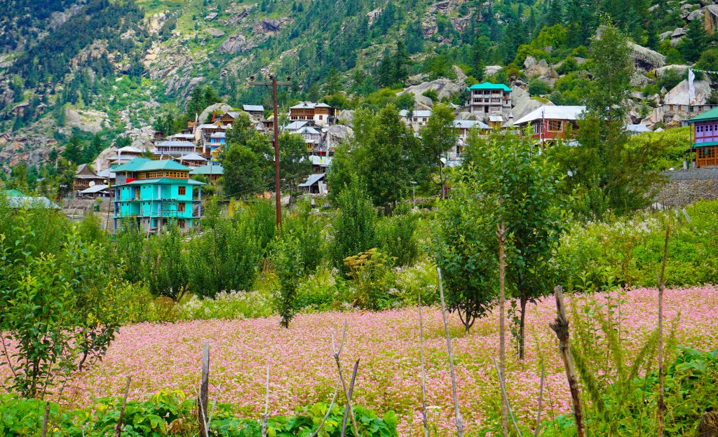
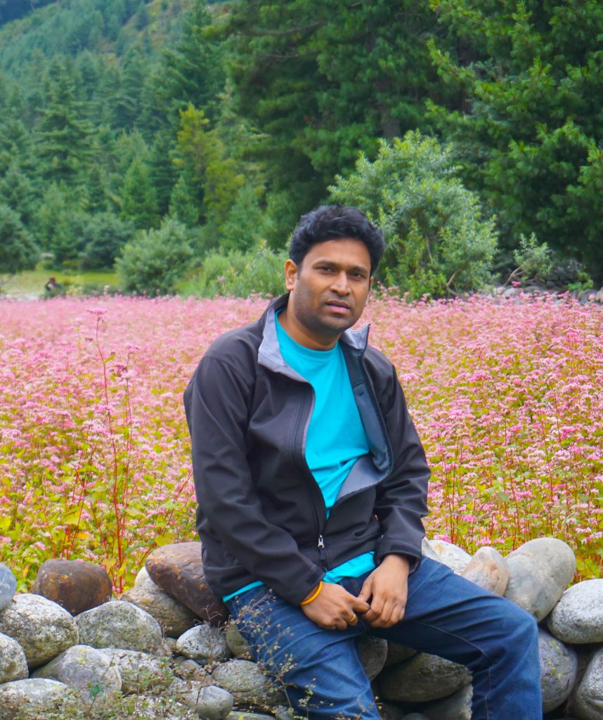
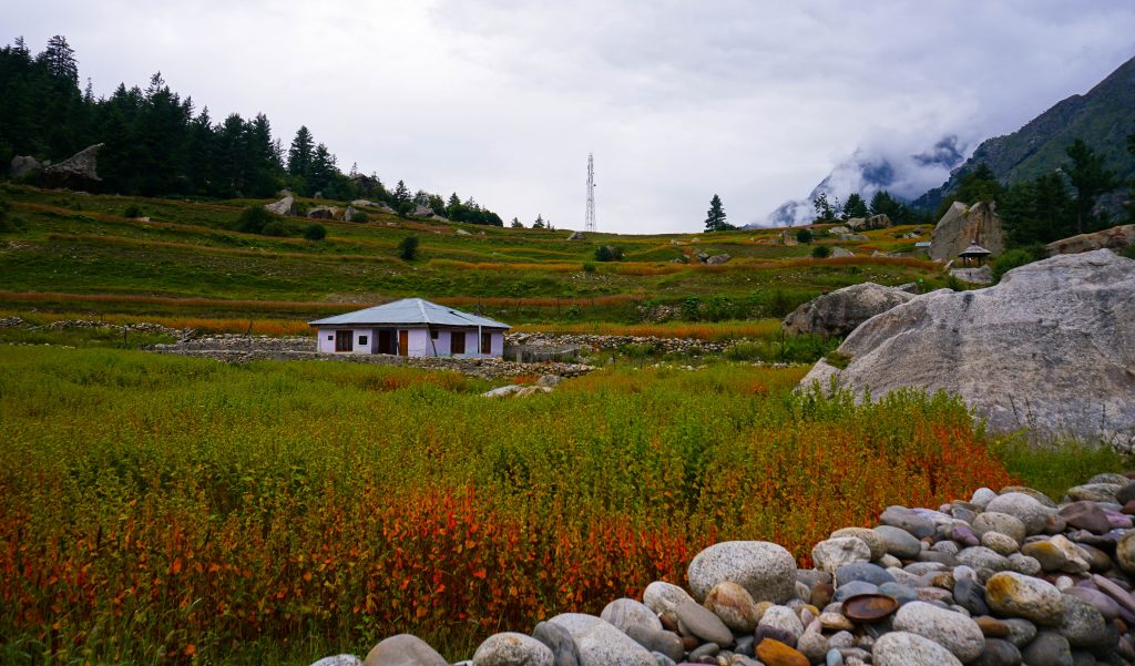
‘Ogla’ or buckwheat is cultivated extensively in the Sangla valley and is the staple food of the area. The orange and pink flowers of the buckwheat plant gives the valley the lovely colours which harmonizes well with the deep greens of the surrounding conifer trees, the blinding white of the mountain streams joining Baspa river and the smoky greys of the moraines. Combined together, this canvas of nature is hard to beat.
Even within the eye-popping beauty of the Sangla valley, the picture-perfect Rakchham village stands out. It is truly a painter’s canvas with each shade lovingly applied to create a balanced, happy whole.

Chitkool – Kalpa
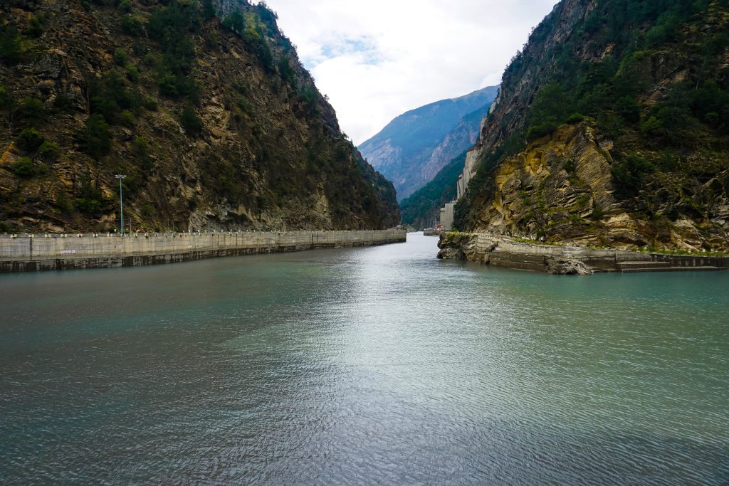
On the fourth day, we rejoined the Hindustan Tibet highway at Kharchham and continued our journey into Spiti valley. On our way we passed the well-known Karcham Wangtoo Hydroelectric Plant built on Sutlej and Baspa rivers. Built with an installed capacity of 1000MW, this power station mainly supplies power to Punjab, Haryana, Uttar Pradesh and Rajasthan.
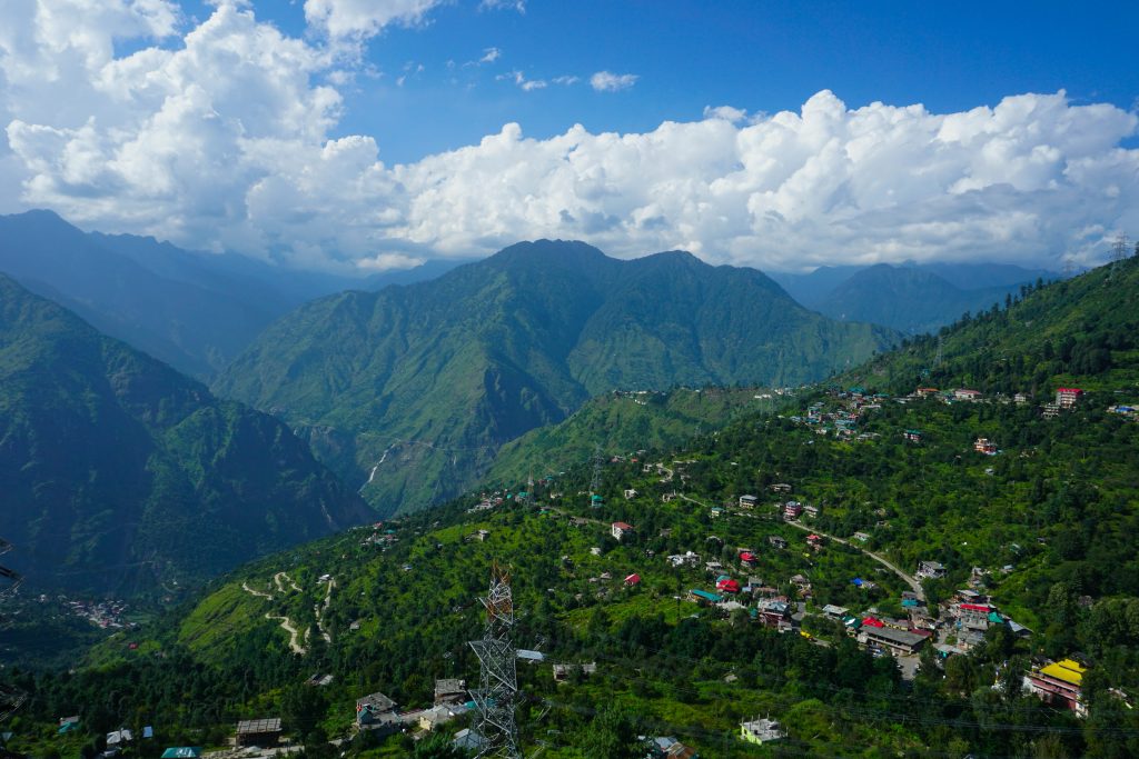
About 20 kilometers from Kharchham, Rekong Peo at 7513 feet is the head-quarters of the Kinnaur district and an important town of the area.
A further 3 kilometers from Rekong Peo and at an elevation of 9711 feet is Kalpa, a little hamlet located at the base of the Kinnaur Kailash ranges. Surrounded by deodar, apple, and chilghoza (pinus gerardiana) trees, Kalpa on a clear day, affords a view of the famous Kinner Kailash in all its splendour.
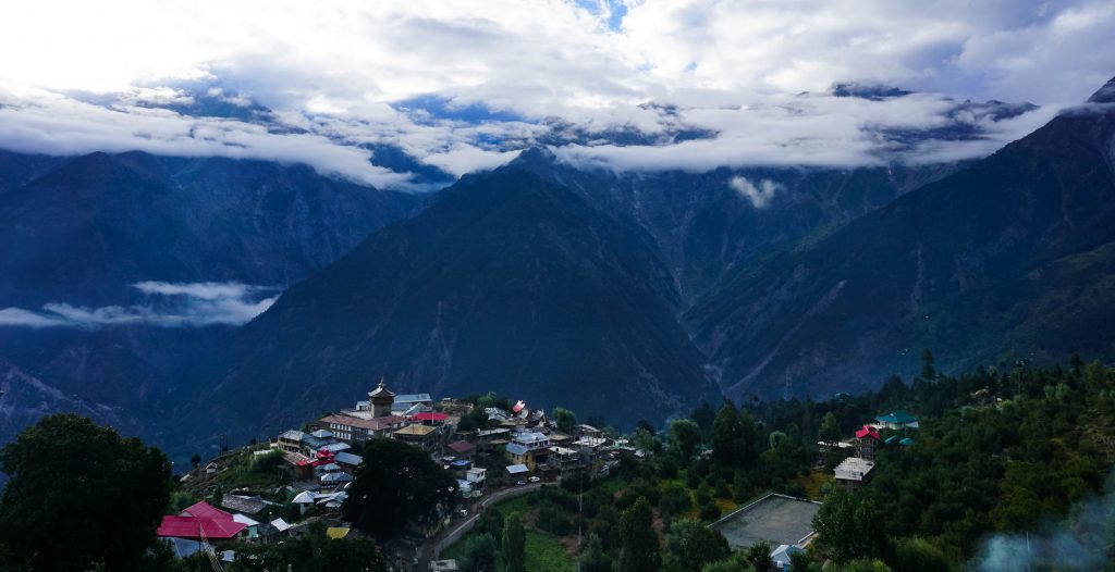
As is the case all over Kinnaur district, in Kalpa too, religion is a mix of Hinduism and Buddhism with temples and monasteries existing side by side.
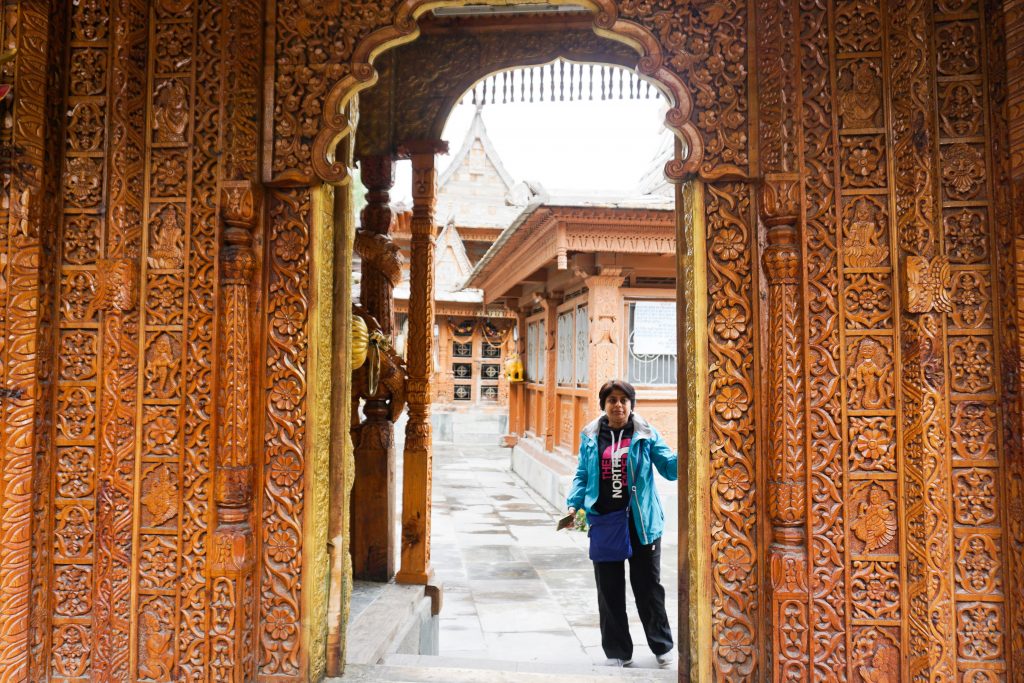
Below is the intricately carved entryway of the Kalpa temple, an exceptional example of the Himachali architectural style utilizing optimum use of local resources – stone and wood.
The first leg of our Spiti sojourn covering Kinnaur and Sangla ended at Kalpa/ Reckong Peo. Next day we continued further into the Spiti valley, the next segment of our itinerary.
Binay, Mahuya! This is amazing! I’ll have to take out some good time to read the other parts aaram se 🙂