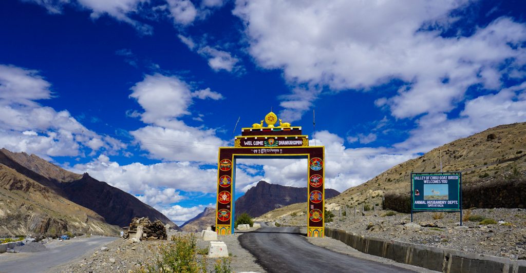
Nestled in the trans-Himalaya mountains in the north-eastern part of Himachal Pradesh (India), the Spiti valley is literally a cold desert that lies between two of its better-known neighbors – Tibet and Ladakh. Apparently, the name “Spiti” means “The Middle Land”, indicating the land between Tibet and India.
Aptly described as “A World within a world” by Rudyard Kipling, Spiti is bestowed with abundant blessings of nature in the form of snow-capped peaks, rugged mountain ranges, tranquil rivers, pristine lakes, sprawling valleys, and endangered wildlife. Culturally, it is dominated by Buddhism and has some of the ancient and finest monasteries.
Kalpa – Nako – Tabo
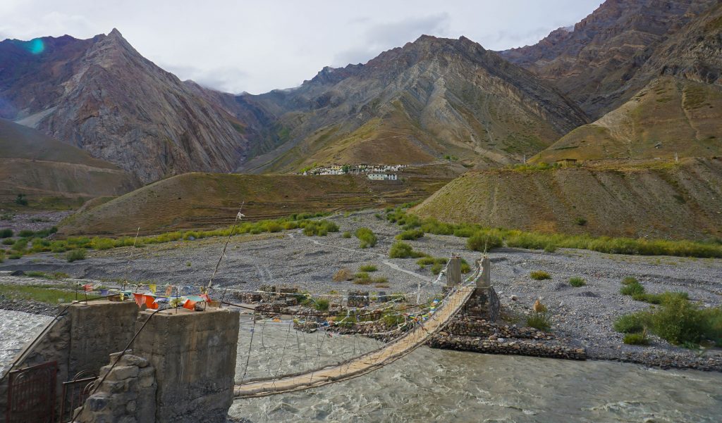
Our fifth day commenced bright and early (7.00 A M) – this is the day when we had to travel 7 hrs and traverse 150 bone-jarring kms over Hindustan Tibet highway. After crossing small towns like Pooh and Spillow, we reached Khab, the confluence of Spiti and Sutlej rivers. This is where we left Sutlej and started following Spiti river and entered into actual Spiti valley.
Bordering Kinnaur district and acting as entry to Spiti valley is the stark Hangrang Valley, an area of denuded hills in fantastical shapes. The landscape changes dramatically – the hills are no longer green and the sky full of clouds. Instead the landscape starts turning barren with isolated greenery around the water courses and the sky turns a deep blue.
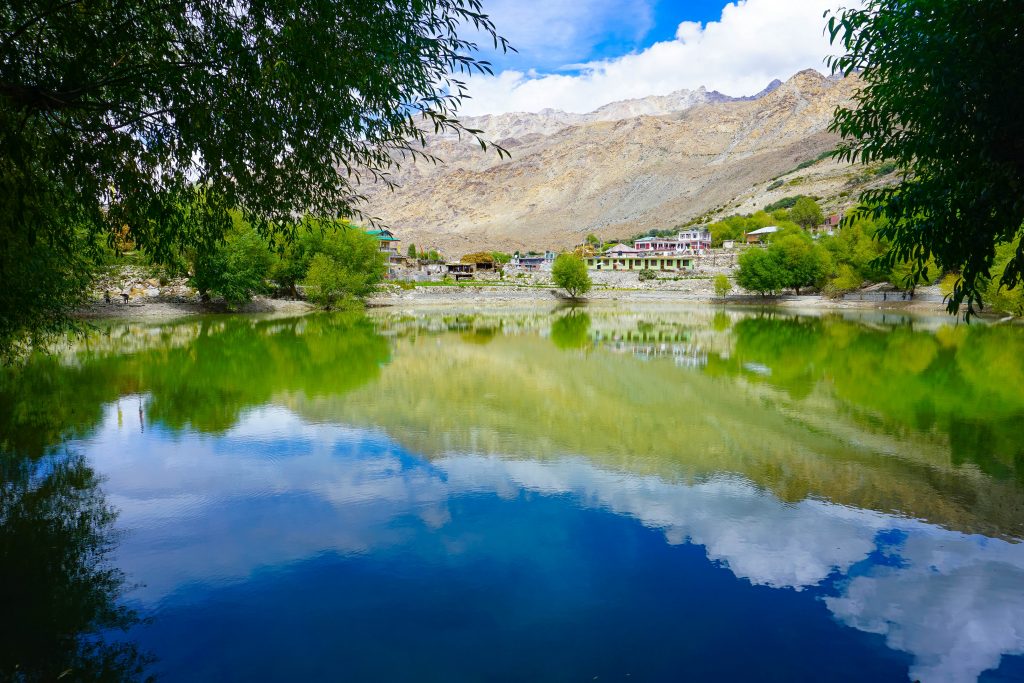
The largest village in Hangrang valley is Nako. At a height of 11,893 feet, it is the highest village in H P and lies in a seismically active zone leading to frequent slides and quakes. The Nako monastery established in 1125 A D is the focal point of the village.
Nako lake, just on the border of the village is located at an elevation of 11,929 feet and is surrounded by willow and poplar trees. It is said that there is boating on the lake during summer (we did not see any evidence to support this claim) and ice-skating during winter (this claim is more believable).
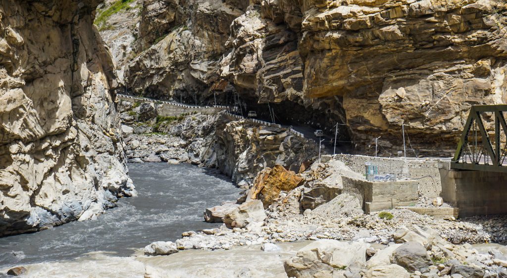
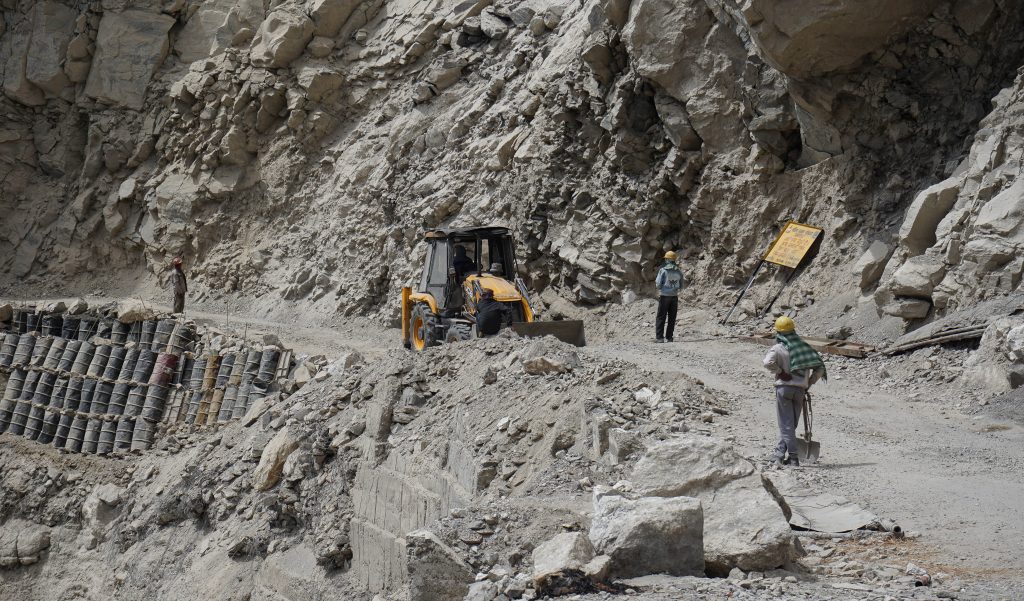
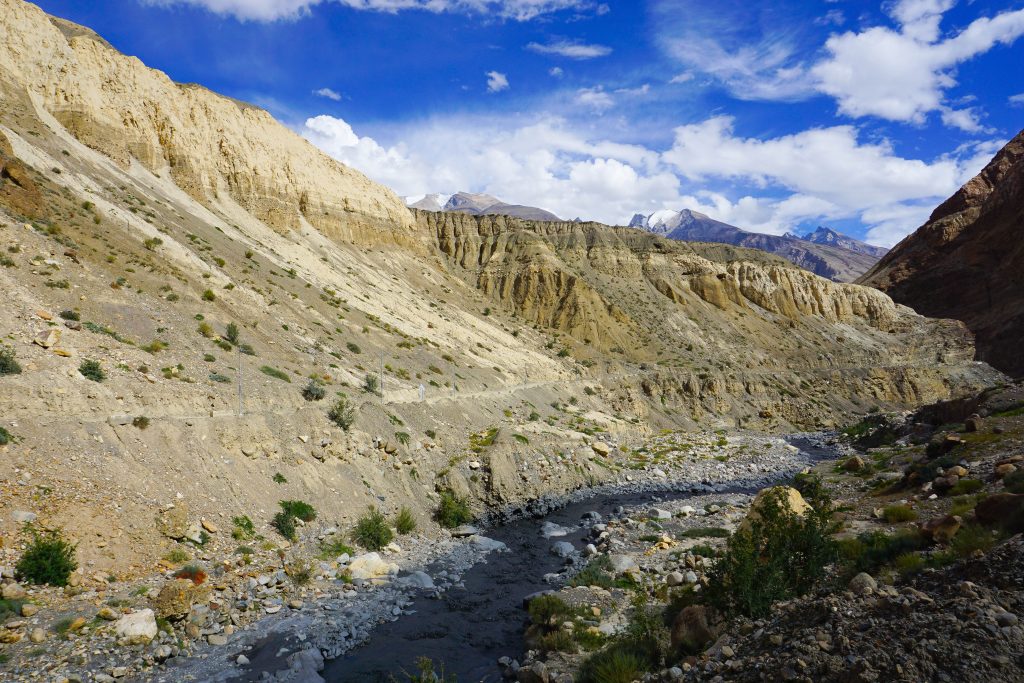
Moving on from Nako, the road condition deteriorates steadily, and at places is almost non-existent. Thanks to our Border Roads Organization (BRO) and their relentless supervision, roads are never closed for too long barring major landslides. A number of stretches are very treacherous, with almost continuous rock-falls. This is due to the extreme young age of the landscape – you can literally see it changing shape before your eyes.
We did experience it first hand after crossing the Malling Nallah (itself a horror, threatening to wash away our vehicle) when we had to wait for a better part of an hour while BRO team cleared freshly-fallen debris and stabilized the road for traffic movement.
Continuing on this treacherous stretch for another 1 hour we reached Sumdo village. 8 kilometers further on, a road meanders to Gue village, famous for a 500 year old mummy of a Buddhist monk, Sangha Tenzin. An interesting feature of this detour was the black waters of the Gue Nallah – probably a result of the water draining through the black shale hills around the Gue village.
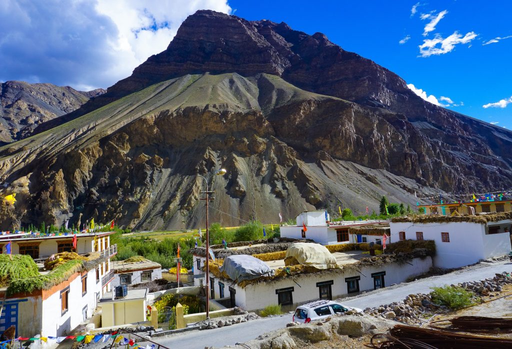
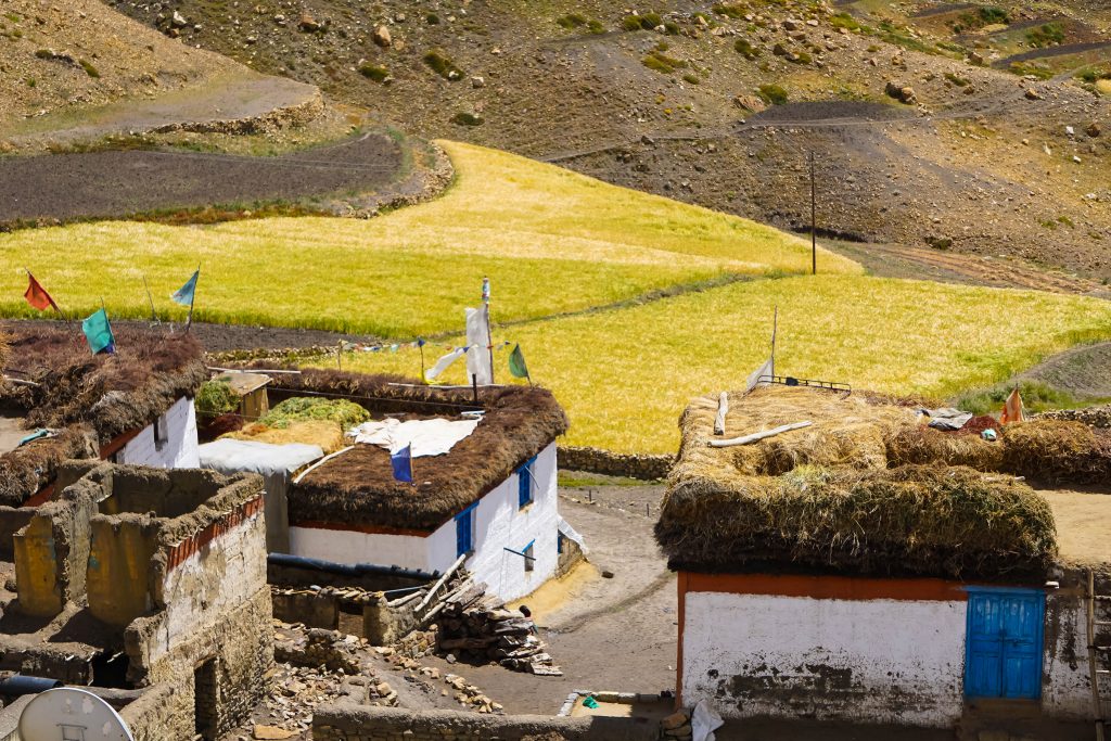
The long, arduous journey of the day culminates at the beautiful village of Tabo which appears as an oasis amidst the barren landscape of Spiti.
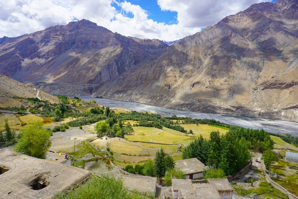
Before reaching Tabo, the road descends to the valley bottom, green terraces and orchards reappear and the land brightens up from its brooding mood.
Cultivation in the Spiti valley is limited only to the short summer months of June, July, August and September.
A single crop of barley, peas and seabuckthorn are grown in small terraced plots. Drip irrigation by means of tank water is predominantly used for growing crops.
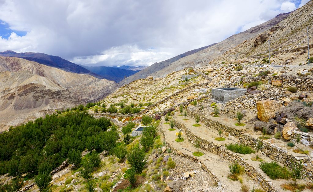
Recently, a horticultural revolution has been ushered in by the University Research Station at Tabo with the introduction of locally grown and acclimatized apple plants that have proven to be superior than the better known Shimla apples.
In addition to terrace farming, apple orchards are coming up all around Tabo, thus improving the economic conditions of the farmers here.
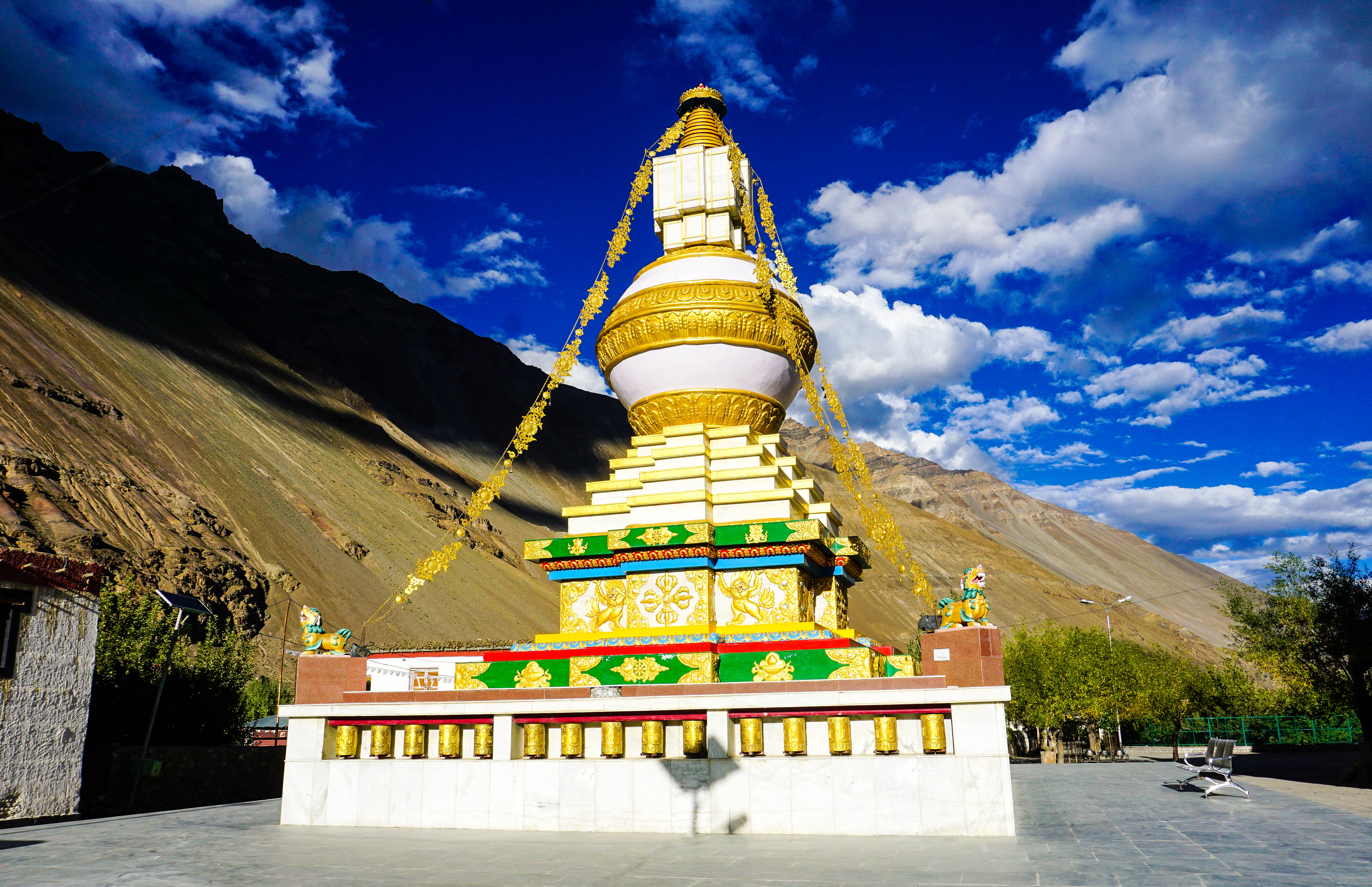
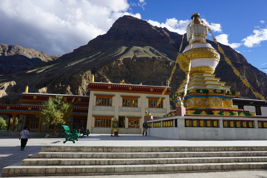
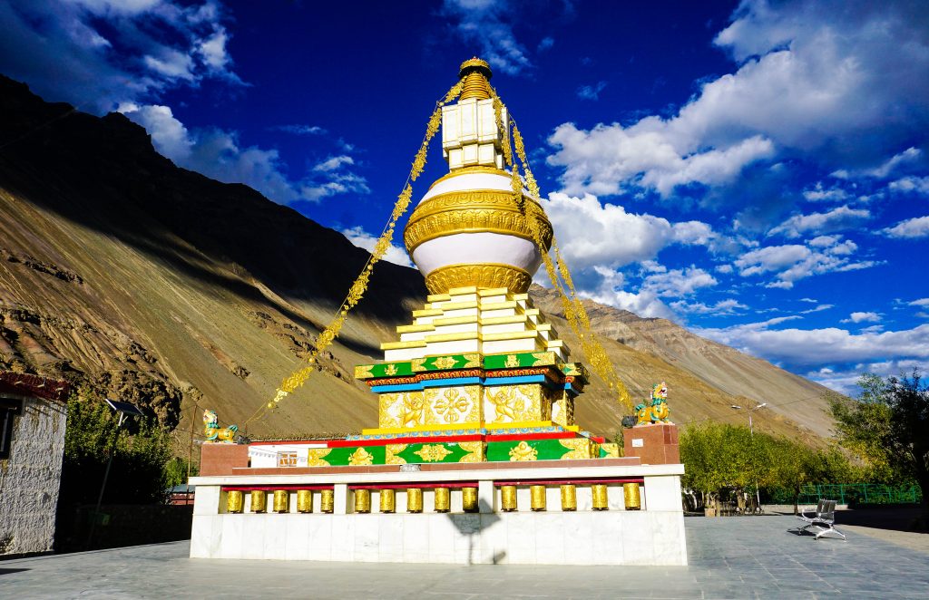
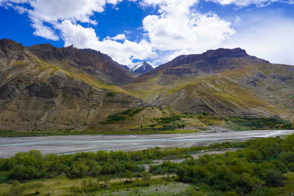
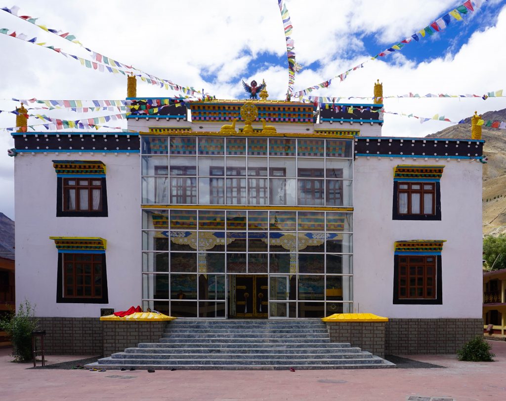
Situated at a height of 10,760 feet, Tabo is a picturesque village spread out around the Tabo monastery. Situated on the banks of Spiti river, it is known for being the oldest continuously operating Buddhist enclave in both India and the Himalayas.
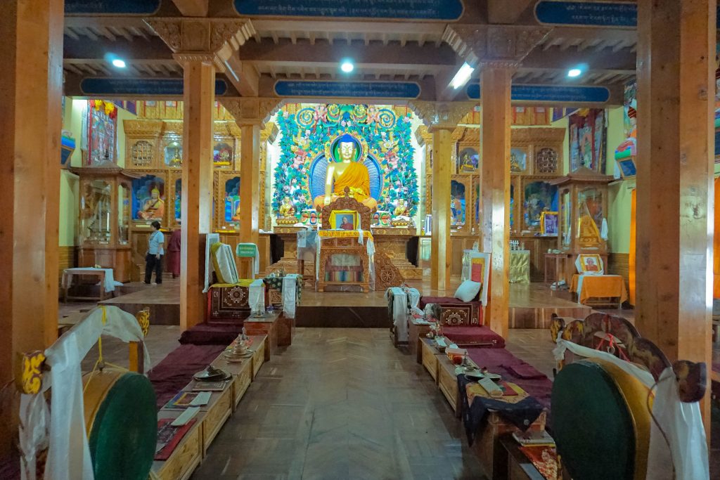
Tabo Monastery or the formally named Tabo Chos-Khor Monastery was founded in 996 CE in the Tibetan year of the Fire Ape. It was built as a ‘daughter’ monastery of the Tholing Monastery in Ngari, western Tibet and contains a large collection of frescoes depicting tales from the Buddhist pantheon.
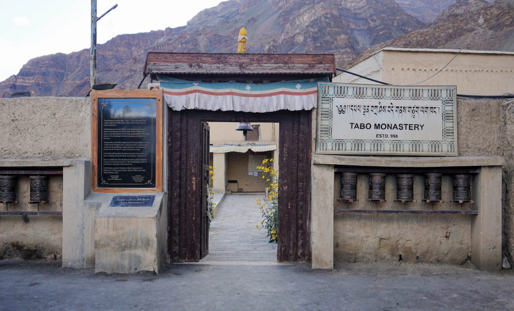
The old monastery built in 996 AD blended the provincial and regional characteristics of India and Central Asia. The main temple is conjectured to represent the entire Vajradhatu (diamond realm) Mandala.
The monastery also has a huge collection of manuscripts and Pramana (literally means proof) texts.
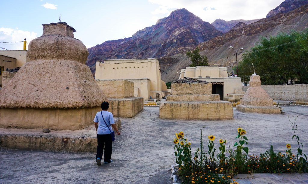
The ancient monastery was built like a fort with very strong walls, about 3 feet thick. As a result it is still standing after centuries of depredations and natural calamities. The temple complex surrounded by a high mud brick wall has a no. of chortens and monks’ residences.
The original monastery was severely damaged in the 1975 Kinnaur earthquake. Subsequent to its full restoration and the addition of new structures, the 14th Dalai Lama visited the monastery and initiated the Kalachakra Festival (a process of initiation and rejuvenation) in 1983.
The monastery is now protected by the Archaeological Survey of India (ASI) as a national historic treasure of India.
Tabo – Dhankar – Pin Valley (Mudh Village)
On the sixth day, we started towards Pin Valley, a leisurely 3 hour drive through Dhankar.
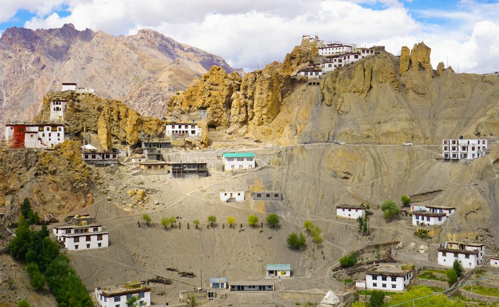
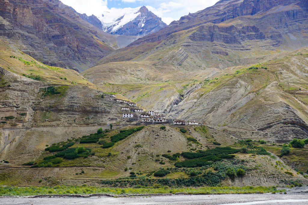
Dhankar is a medium sized village situated on a spur about 17 kms from Tabo. Situated at 12,774 feet, it was once the capital of Spiti and now wears a forlorn and abandoned look that belies its historical importance.
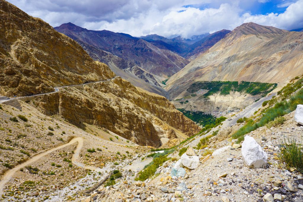
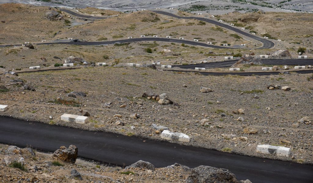
A detour from Tabo-Kaza road climbs up the hills to Dhankar. The road is newly metaled, though narrow. From the top, the Spiti valley opens up in all its beauty while the black switchback road provides a sobering effect drawing attention to the risky drive.
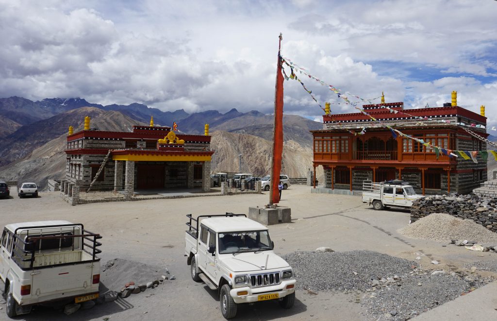
The once important Dhankar village is a depressing place today surrounded by towering sandstone pillars. Both the monastery and the fort are in a state of disrepair, though we did notice local efforts were on to collect money for renovation.
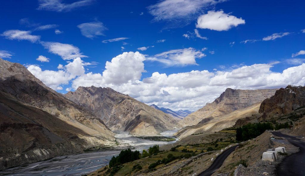
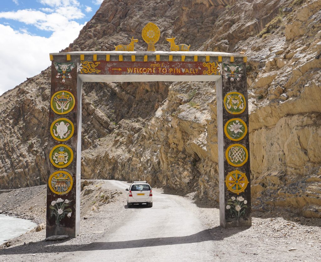
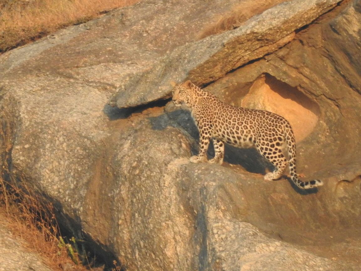
From Dhankar, we continued on to our next destination, the Pin Valley National Park. Drained by a tributary of Spiti river – the Pin – the valley is a high altitude cold desert area ranging in elevation from 11,500 feet to 20,000 feet at its highest point. The national park is home to ibex and its predator, the snow leopard.
The snow leopard is known as the ghost of the Himalayas locally and is hardly ever spotted 🙂
The Pin river cuts through a wide valley, full of glacial debris. Sudden water surges due to rains in the catchment area are common, as attested to by a no. of destroyed bridges along the course of the river. Once a bridge and its connecting road are washed away, a detour is opened up through the river bed itself. Travelling on such stretches are highly risky particularly during days when it rains in the upper reaches.
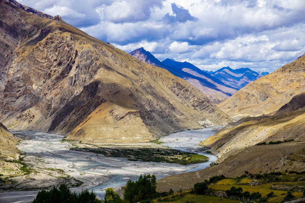
Overall this valley is greener than the Spiti valley – there are few trees but alpine meadows, moss and lichen provide color to the unrelenting dun colored landscape.
The Pin valley, particularly the village of Sagnam is famous for Chhumurti horses, an indigenous breed of well-muscled mountain ponies, believed to have descended from the hardy horses of the steppes of Central Asia.
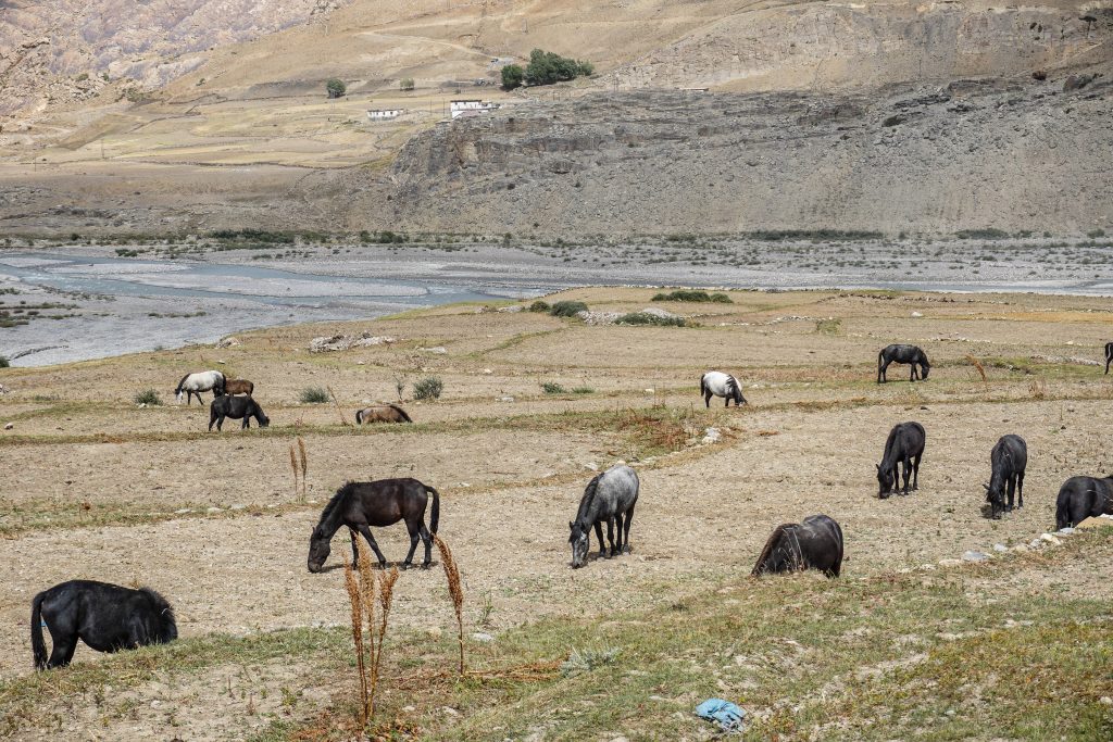
For centuries, these horses were used by the people of the Pin valley to transport silks, salt and other trade goods over the high mountain passes between Tibet and India. Even our Indo-Tibetan Border Police use these horses as pack animals.
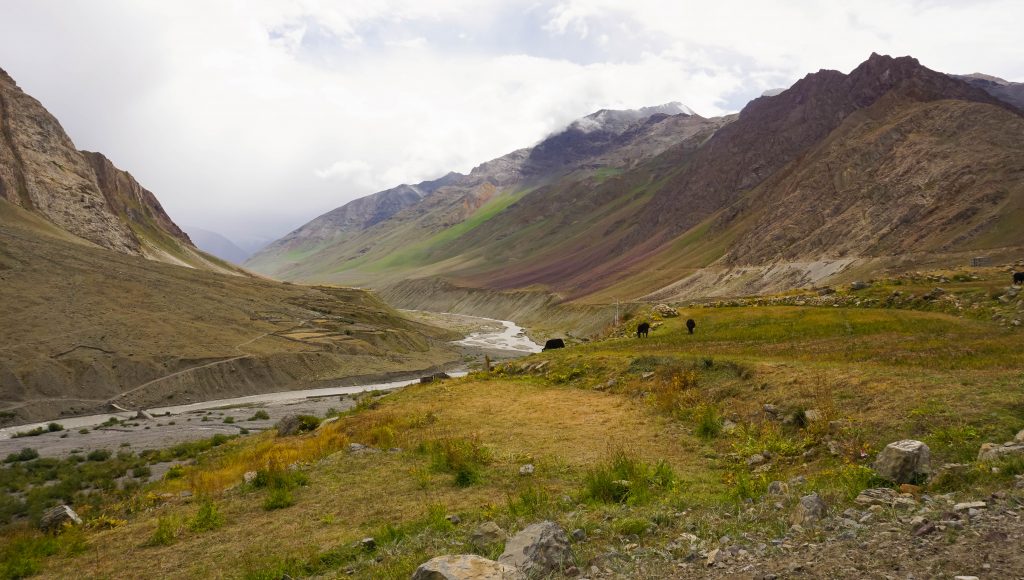
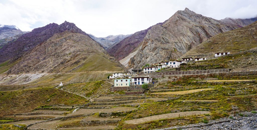
Our night halt in Pin valley was the village of Mudh, the remotest of all the villages in the valley. While travelling towards Mudh, we crossed the villages of Kungri, Sagnam,Tailing – uniformly tiny hamlets perched precariously along the river banks.
Mudh village, situated at an altitude of 12,300 feet is an important base for treks in the Pin valley area. Both the Pin-Parvati and the Bhaba pass treks start from the Mudh village.
To counter the extreme cold (-30 degree Celsius in winter) the houses in the Pin valley are constructed using an indigenous method called rammed earth technique. This technique uses raw earth with a high moisture content, with a layer of locally available grass in between two layers of mud. This serves as a very effective thermal mass wall, insulating the building from outside cold without freezing and making it highly appropriate for the bitterly cold winters.
The journey continued further to explore Kaza and its surrounding regions.
Great writeup about spiti and awesome pictures. This is now on my to visit list.
Amazing scenic beauty captured. Good information provided about the place.
Appreciate your comments.
This speaks volumes of our rich culture and heritage. You footloosers have captured them tightly inside the camera. :